
Use case
Case Study: Copper Prospectivity - Torrens, South Australia
August 22, 2026
MinersAI brought 28 public datasets together into a single standardized copper prospectivity project across South Australia's Torrens region, spanning geology, geochemistry, magnetics, gravity, and radiometrics. The model achieved a consensus out-of-fold ROC-AUC of 0.69, meaningfully separating prospective ground from the rest of the project area.
The Region
South Australia’s Gawler Craton is one of the world’s premier iron oxide copper-gold provinces. It hosts major systems including Olympic Dam, Carrapateena, Hillside, Khamsin, and the historic Moonta–Wallaroo district.
This project covers approximately 26,000 km² across Block 3B (Torrens), an area where much of the prospective geology is hidden beneath younger sediment. Within the project area are 77 recorded deposits and occurrences, including 41 where copper is the principal commodity.
The Challenge
The main exploration challenge is cover. In many places, the prospective basement is buried beneath hundreds of meters of sediment, limiting the value of surface mapping and conventional geochemistry.
Finding new targets requires combining multiple lines of evidence, including drillhole geochemistry, magnetics, gravity, radiometrics, terrain, and cover thickness.
The platform value in one sentence: MinersAI brought 28 public datasets into a single standardized project, replacing weeks of manual data acquisition, preparation, and GIS integration.
What We Built
The project integrates 28 datasets across five evidence layers:
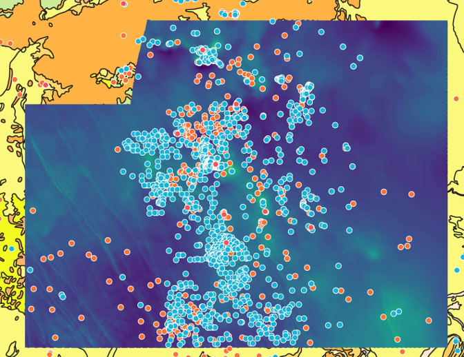
All datasets are standardized, co-registered, and viewable together in one workspace, with the resulting prospectivity maps returned to the same project for interpretation and export.
What the Model Found
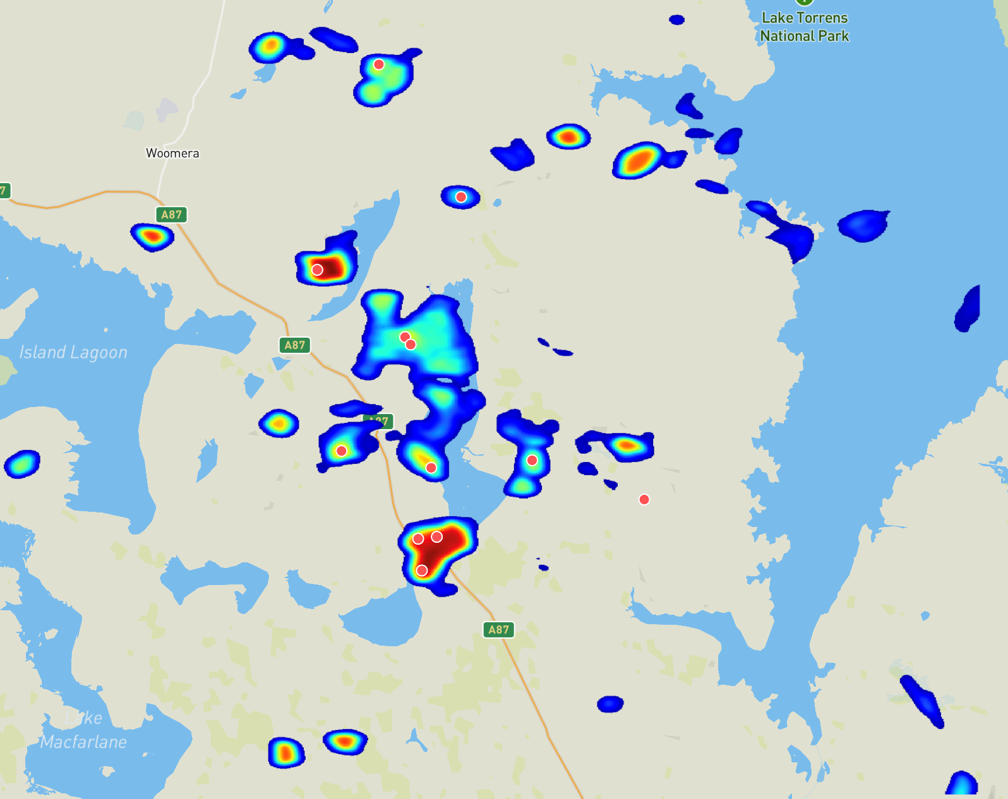
The strongest prospectivity pattern is a copper- and uranium-enriched IOCG signature aligned with the known Carrapateena–Khamsin–Fremantle Doctor corridor.
The model also identifies magnetically elevated basement and strong magnetic-gradient zones that may represent favorable structures, alteration systems, or geological contacts.
Together, these outputs help separate different styles of prospective ground rather than presenting a single undifferentiated target map.
Model Performance
ROC-AUC: The model achieved a consensus out-of-fold ROC-AUC of 0.69, showing meaningful ability to distinguish more prospective ground from less prospective areas across the project.
The top 10% of ranked ground captures 21.3% of known deposits, representing a 2.1x improvement over random selection.
The strongest predictive signals came from drillhole geochemistry and high-resolution magnetics, with terrain data adding useful structural information through cover.
The Takeaway
MinersAI transformed 28 public datasets spanning geochemistry, magnetics, gravity, radiometrics, geology, terrain, and cover depth into a ranked copper prospectivity map over 26,000 km².